We first took a brief look at Geoloqi in October 2010. Since then the company has not disappointed. For background, Geoloqi offers a mobile platform for tagging data, annotating, social sharing and messaging based on geo-location of a user. The server portion of platform provides an API for 3rd party developers to construct additional apps that leverage Geoloqi’s geo-notation features.
Here’s a quick look at several key features of the Geoloqi mobile app and platform.
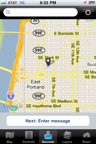
 1. Personal Geonotes. The app allows a user to record a personal note tied to a specific location. The note can then be pushed to the user’s smartphone when she gets to that location. It’s a relatively simple process: click on a map, locate the specific place for the note, enter the text, and then “send”. The Geoloqi platform stores the note and then sends it when the the user (and smartphone) next visits that location. For instance, a user might leave a geonote at the grocery store on the map as reminder to “purchase a frozen pizza”. When the user visits the store the reminder text will be sent to the user to “purchase a frozen pizza”. The geonote feature seems particularly useful for travelers who may need specific information based on their specific location.
2. Geonotes for Others. The Geoloqi app allows a user to leave geonotes for other people. In this case, these are triggered by the recipient arriving at the location tied to the geonote. The platform even estimates how likely it would be for the recipient to receive the note based on his prior travels over a specific period, such as 30 days. When triggered, the user receives an SMS message and the sender gets a confirmation email.
3. Opt-in Tracking. The platform is built around the notion of opt-in / opt-out. This gives a user full control over if and how his or her location is shared with others. The feature allows a user to share location information temporarily based on a specific time period as well. For instance, a user may wish to share location information for an off-campus meeting with a work colleague. The user can enable location sharing for, say, one hour. The recipient will then receive a link that allows him to track the sender’s location in real-time over the one hour period.
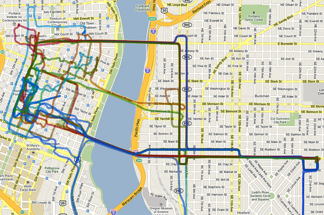
 4. Historical tracking. A user can track her movements on the map over a period of time. This historical data can then be made available for further analysis.
5. Information Layers. The platform allows layers of location based information to be added over a basic map. For instance, a current demo version allows a user to superimpose earthquake data from the U.S. Geological Survey that shows recent earthquakes in proximity to the user.
A key concern about the Geoloqi service is the privacy of data relating to a user’s movements historically and in real-time. However, leaving this concern aside for now, the Geoloqi platform provides a significant opportunity by a making a person’s location actionable. This opens up a spectrum of unique services that have yet to be dreamed up, and because of the availability of an API, open to others to exploit. Geoloqi has only just scratched the surface with this platform.